Flood Risk Assessments Delivering Resilient Developments
Our flood risk assessments comply with National and Local Planning Policies. You can rely on our reports for your planning application
We are a dynamic flood risk assessment consultancy with substantial experience in supporting planning applications for sectors such as housing, commercial, recreational, renewables and infrastructure.
Our expertise enables us to provide full range of services for any size development. We are able to create 1D and 2D river models and assess your development within flood zone 2 and flood zone 3, critical drainage areas or in areas where the flood levels are unknown. We can also produce sequential tests and exception tests for your site.
Benefits of our Flood Risk Assessments
You receive clear and specific advice which:
Enables you to make informed changes to the design and achieve planning
Our Clients


Our Reports
Join the hundreds of architects, planners and developers who are using responsive technical data and clear engineering judgement to get their developments underway.
Flood Risk Statement
£450.00
-
Any size development
-
Confirms whether or not a detailed flood risk assessment is required
Flood Risk Appraisal
£750.00
-
Any size development
-
Details site potential within the floodplain before making an investment decision or starting your master plan design
Flood Risk Assessment – 50000 (m²)
Flood Risk Assessment – 5000 (m²)
Flood Risk Assessment – 2500 (m²)
Flood Risk Assessment – 1000 (m²)
Flood Risk Assessment – 250 (m²)
Flood Risk Assessment – Low Risk
The benefits of using our flood risk assessments for your planning application
- You receive the first reports in 48hrs. This allows you to register your planning application
- Reduced the time and costs associated with delayed planning applications
- Increased chances of obtaining planning permission for your developments
- Helps you make design decisions based on detailed knowledge of flood risk mitigation and interventions
- Fixed price for all our flood risk assessments
- We support you through the planning application until a decision is made
When would you get your flood risk assessment?
You will get the initial flood risk assessment in 48hrs. You can validate your planning application right away if you have a tight timescale. You can also use this report to inform your design team of the possible flood risks constraints and resilience interventions.
Our Flood Risk Assessment Methodology
Our flood risk assessment methodology is based on obtaining the best possible data and using our engineering judgement and experience to get your development through planning.
During this process, we are proactive in giving you proven solutions to flooding and are available to discuss design approaches that architects or designers may have.
The flood risk assessment methodology includes
- Obtaining your development’s drawings and levels
- Consulting the available databases and obtain all relevant flood risk information
- Liaising with the Environment Agency and local planning authorities to understand their requirements
- Agreeing with the Environment agency your flood risk assessment climate change allowance
- Evaluating the detailed flood risk information for river, sea, groundwater, run-off, reservoirs, and critical drainage areas
- Providing clear advice on how to mitigate the risk of flooding
Our Civil and Structural Engineering backgrounds ensures robust solutions that strengthen your planning approval whilst following the Environment Agency standing advice for flood risk assessments.
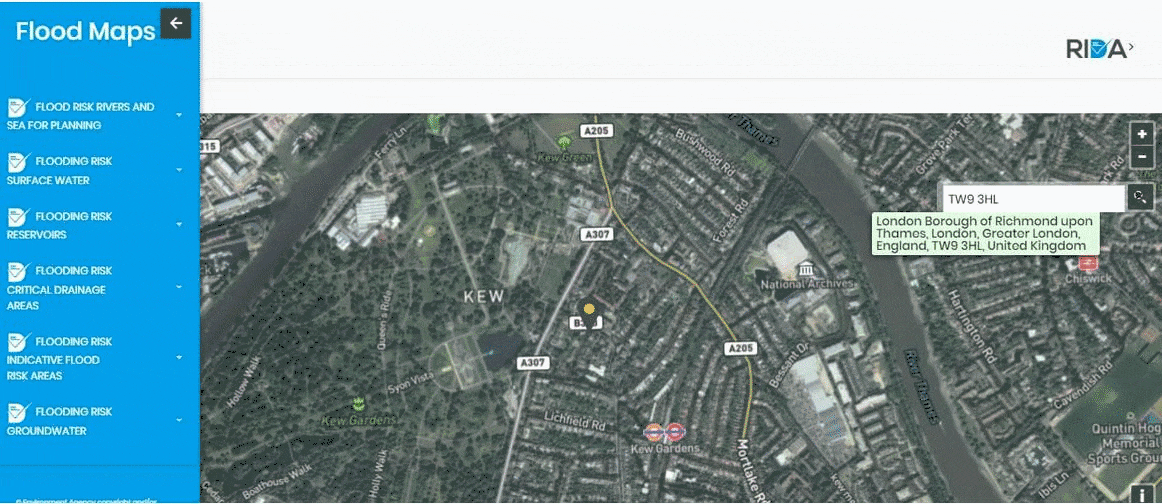
Maps
Our Flood Risk Assessment Maps
They have been made with you in mind
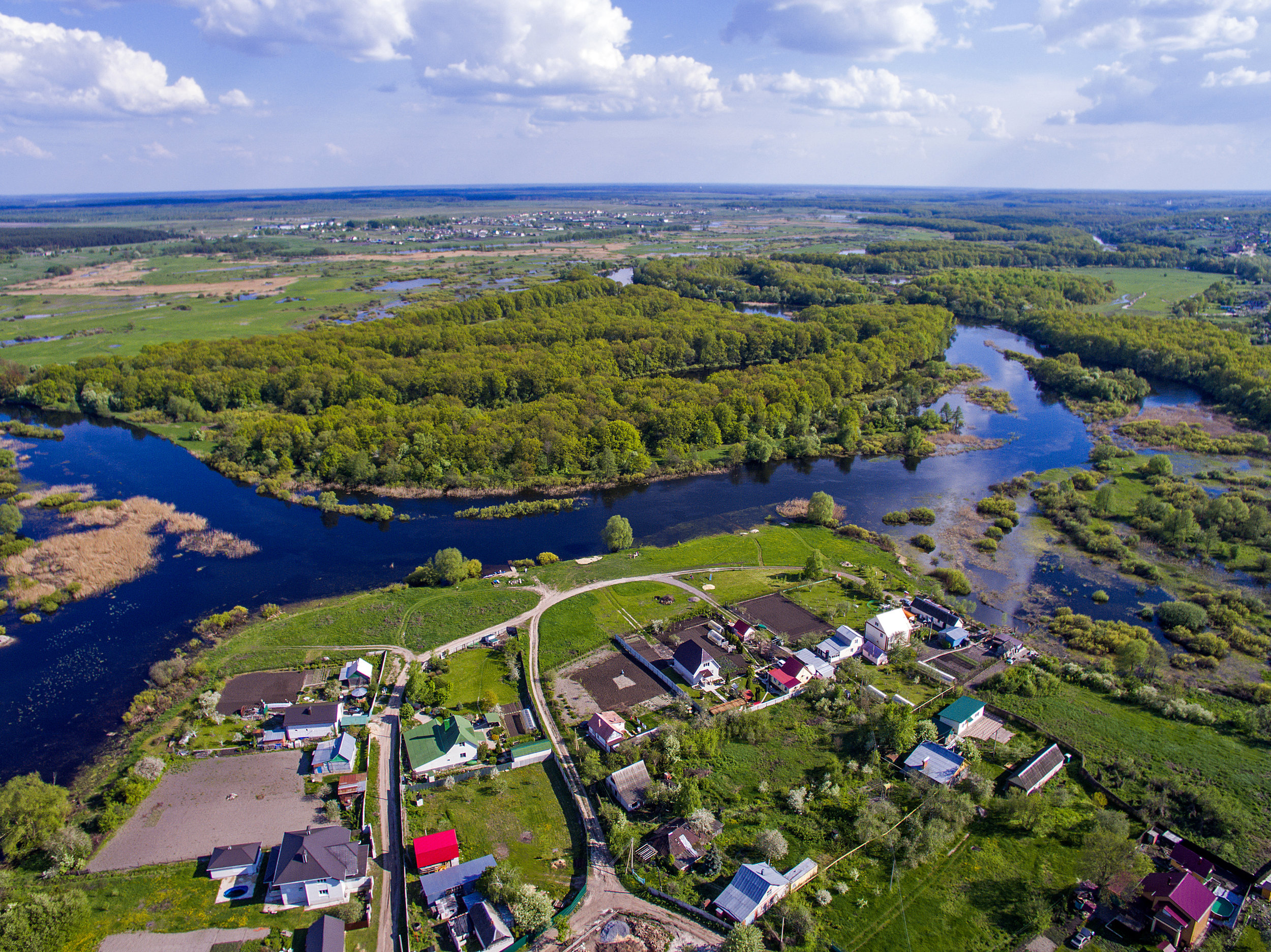
Our flood risk assessment map for England has been developed to check if your development is in a flood zone or affected by other sources of flooding.
We have taken this information directly from the Environment Agency databases and prepared it so you can check in detail if your development need a flood risk assessment.
You can also check the following maps
- Flood Maps England: Environment Agency Flood Map for Planning
- Scotland: Scottish Environment Protection Agency flood maps
- Wales: National Resources Wales flood map
- Northern Ireland: Flood maps (NI)
Services
We provide a flood risk risk tailored to your needs, these are the detailed services we can also offer as part of the flood risk assessment.
Detailed sequential and Exception Tests
1D & 2D Detailed River Modelling
Flood Warning and Evacuation Plans
Flood Risk Mitigation
Drainage Strategies
Flood Maps
What Our Customer Says
We have had the pleasure of working with Arge at RIDA over several years and throughout this time the experience has consistently been very good. What stands out most is their responsiveness - any queries or issues have always been addressed promptly, which has given us great confidence and peace of mind.
FAQS
The National Planning Policy Framework (NPPF) has determined that any new development or change of use requires a flood risk assessment to make sure the development is safe and does not cause flood impact to others. The NPPF and its Technical Guidance is based on law and all the councils should ensure that it is followed.
The flood risk assessments approved by the Environment Agency and the Local Council. The approval level depend on the size of the development, flood risk type and user vulnerability.
The Local Council approves the flood risk assessments for small developments with run-off flood risk and less vulnerable users. The Environment Agency approves flood risk assessment for all development affected by flood risk from rivers and sea. You can protect your development by using the Nature Based Solutions.
A flood risk assessment is required when making a planning application for a development which is located in the floodplain or in an area affected by flooding.
It is because the Environment Agency has the flood water level information for all the major rivers in England. Their statutory response time is 21 working days.
The Environment Agency runs the hydraulic model for the river and produces a Detailed Flood Risk Assessment Map, including flood zones, flood defences, storage areas, areas benefiting from defences, statutory main river designations, historic flood event outlines and more detailed information of computer river models
A hydraulic model is a mathematical model which can predict the likely water levels and the flood extent of the river. We use hydraulic modes when the Environment Agency does not have the river levels. Rida Reports integrates the management of water within towns and developments and helps you to determine the flood depths.
Flood Zones 2 and 3 are flood risk areas. They are determined by storm event probability. There are 4 flood river zones in England. Flood Zone 1 has low flood risk, flood zone 2 has a medium flood risk and flood zone 3 has the highest flood risk.
Flood zone 3 is divided into Flood Zone 3a and 3b.
Flood Zone 3b is an area that the river can use as flood water storage. Flood zone 3a is the watercourse bed or the functional flood plain. This is the area that is used constantly by flood water.
You know if your property is in the river flood zone by:
Consulting the Environment Agency flood risk map for planning
Determining if part of the house or development is within the blue area i.e. flood zone 2 or a flood zone 3
Obtaining the property ground levels and river flood levels if you are within flood zone 2 or 3. You can obtain the river levels directly from the Environment Agency
Sending an e-mail to enquiries@environment-agency.gov.uk requesting the Product 4 information. Attach a drawing showing the location of your property and the post code
Determining the levels of your property by instructing a Topographical Surveyor to complete a level survey of your house. The levels must be in mAOD
Comparing the Environment Agency flood levels and your property levels
Your property is in a flood zone 2 or a flood zone 3 if the flood levels are higher than your property levels
We can help you with this process and clearly indicate if your property is in the flood zone. We can also help you determine the best ways to protect your property from flooding.